 |
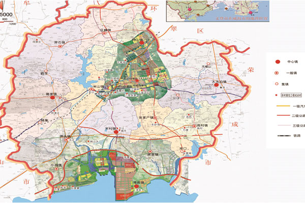
Wendeng district is located in the east of Shandong peninsula, and its coordinate is 36°52'~37°22' North Latitude, 121°43'~122°19' East Longitude. It is facing Yellow Sea in the south, nestling against Kunyu Mountain in the west, neighboring Muping district (Yantai city) and Rushan city, connecting with Weihai Lingang Economic Technology Development Zone and Rongcheng city in the north and east respectively. Its total area is 1614.61square kilometer and its coastline is 155.88km long. According to straight-line distance, the calculated distance between Wendeng with Weihai city proper is 36km, 450km to Jinan (the capital of Shandong province), and 580km to Beijing (the capital of China).
|
It has complicated topography within its territory. Rolling hills, ravines and gullies are throughout this area. The plain is spreading along the both sides of river and coastal area like belt. The mountain region covers 19% of total area, the hills 58.4%, and the plain 22.6%. The Kunyu Mountain in the west is the ridge of Jiaodong area (east to Jiaolai river, including Qingdao, Yantai and Weihai city), the north-south watershed in the west. Its main peak is Taibo peak, with altitude of 923 meters. The Fengtaiding, Laolv Mountain, Zoushan, Laoqing Mountain are the watershed in east area. Looking the whole area, we can find that the two sides are high, the middle part is low; the north part is high and the south part is low, which resembles a dustpan and the mouth of dustpan is facing southward and reaching for the Yellow Sea. |
Wendeng district is facing Yellow Sea in the south and its coastline starts from Caiguantun river mouth, south of Jinjiadian village(37°02′00″N,122°12′00″E) in the east, winding its way to the west and stops in Huangleihe river mouth (37°02′00″N,122°12′00″E) . Its total length is 155.88km. |
Within it territory, there are five main rivers, 36 small rivers; together with tributary there are 1226 rivers courses and the total length is 2147km. Among them, there are 578 river courses that is longer than 1km and their total length is 1814km. Muzhu river, the average yearly runoff depth is 297.4mm, the total length is 58km, and has a basin area of 1115.8 square kilometer. Qinglong river, the average yearly runoff depth is 273mm, the total length is 31km, and has a basin area of 235.8 square kilometer. Changyang river, the average yearly runoff depth is 284mm, the total length is 23.5km, and has a basin area of 119.2 square kilometer. Huanglei river, the boundary river between Wendeng and Rushan, its average yearly runoff depth is 283mm, the total length is 17km. The total shallow sea area in Wendeng is 30,000hectar and the area of fresh water is 3,067hectar. |
Wendeng district, located in North Temperate Zone, is a continental monsoon climate which features in four distinctive seasons. The average annual temperature is 11.5℃, and the recorded maximum temperature is 36.4℃ and minimum -25.5℃. The rainfall is 762.2mm, mostly in summer (70% of total rainfall from June to September) ; while in spring and autumn it is often very dry. The annual duration of sunshine hours is 2540.7, the frost-free season days is 194. The winter is long and dry cold wind from north of continent prevails in this season and the temperature is relatively low, being the low temperature station in peninsula area. The summer is the shortest, the warm and humid summer wind from the ocean prevails. The spring and autumn is in the transit period between winter and summer. In winter it is very windy. |
The total land area of Wendeng district is 161,461.77ha, of which there is 120,930.91ha agricultural land, covering 74.90% of total land. There is 25,811.04ha construction use land, covering 15.99% of total land; 12605.16ha urban citizen and mine land, covering 1.02%; 66.45ha land for water conservancy, covering 0.04%. The unutilized land is 14713.82ha, covering 9.11% of total land.
Wendeng is rich in mineral resources and among them granite resource is richest. The discovered mineral resources include: gold, sliver, iron, manganese, titanium, copper, molybdenum, zinc, granite, brick clay, feldspar, albite, marble, graphite, talc, kaolin, phosphorus, sulfur, iron, vermiculite, quartzite, quartz, garnet, biotite, asbestos, totaling 29 kinds. |
Land natural resources: Wendeng has plenty of biology resources, which plays an important role in protecting the natural environment and keeping the ecological balance.
I. Trees species resources: 64 families woods plants, totaling 312 species.
II. Wild plant resources. 150 families economy plants, totaling 880 species.
III. Wild animal resources, 24 orders, 45 families and 105 species.
Ocean resources: There are about 211 species (genus), 26 species (genera) of phytoplankton,18 species of zooplankton (genus). |
|
|
|